Պատկեր:Austria satellite-map.jpg

Սկզբնական նիշք (2550 × 1381 կէտիկներ, նիշքի չափը՝ 1,22 ՄԲ, MIME-տեսակը՝ image/jpeg)
Ամփոփում
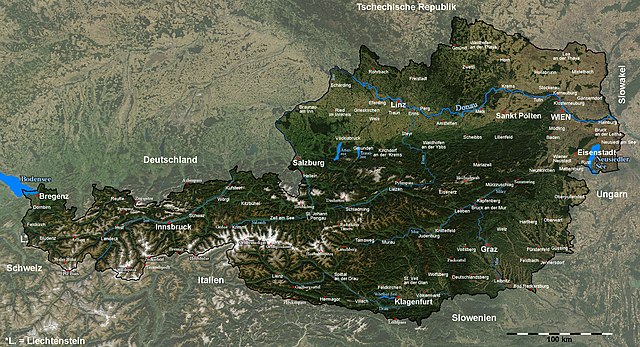
| Նկարագրութիւն | Satellite image of Austria with provincial capitals and other annotations |
| Թուական | |
| Աղբիւր |
The image is based on a satellite image from [1]. Original image: Credit Jeff Schmaltz, MODIS Rapid Response Team, NASA/GSFC. |
| Հեղինակ | Michael Schmid |
| Արտօնութիւն (Նիշքի վերօգտագործում) |
Based on a NASA image, thus in the public domain. |
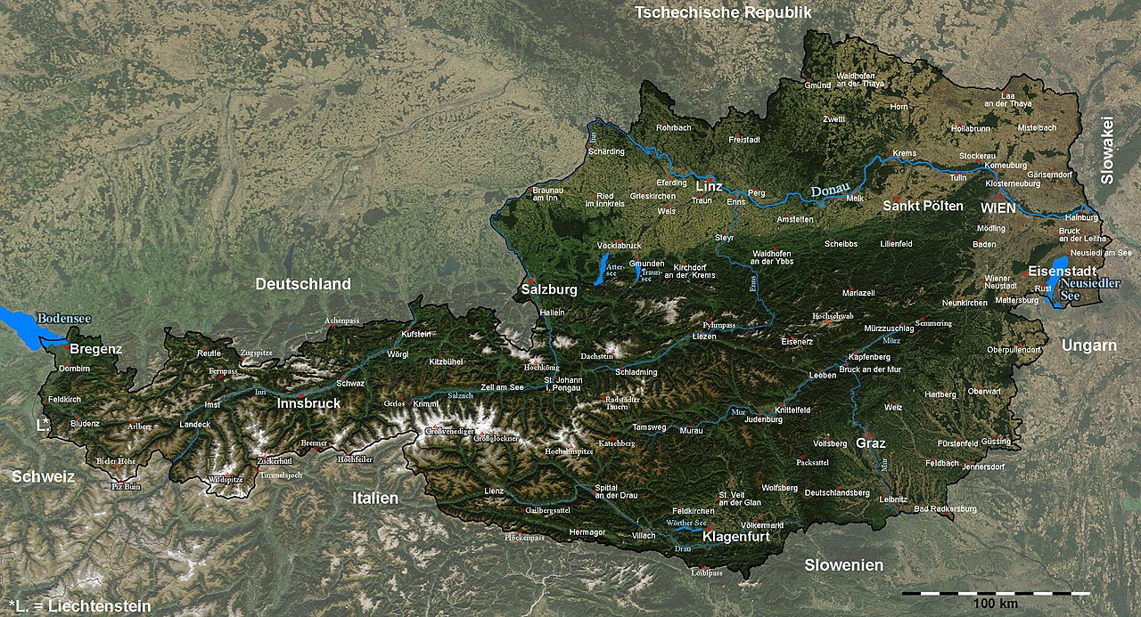
| Այլ մեկնակերպներ | Image:Austria_satellite_unannotated.jpg with no annotations except dots at the positions of a few cities, Image:Austria_satellite_annotated.jpg with some limited annotations. |
![[1]](http://visibleearth.nasa.gov/images/5947/Italy.A2003262.1005.250m.jpg)
I have marked and labelled quite a lot of places with the help of the NASA Worldwind software and several maps. It was quite some work, but also a nice exercise in geography for me ;-).
Unless I have forgotten something, the map shows (among other cities) the capitals of all districts and provinces of Austria.
Please note: The cities of Wien (Vienna) and Linz were marked a few kilometers from their actual locations in the original satellite image; this has been corrected here.[2].
Das Bild wurde in y-Richtung um ca. 5% gestreckt, um eine wenig verzerrte Karte zu erhalten. Um Österreich hervorzuheben, habe ich den Kontrast außerhalb der Grenzen Österreichs reduziert und die Grenzlinie dicker eingezeichnet, und danach durch Vergleich mit der NASA Worldwind Software und diversen Karten die Positionen diverser Orte, Berge und Pässe bestimmt und eingezeichnet.
Die Karte enthält (wenn ich keine vergessen habe) unter anderem alle Landes- und Bezirkshauptstädte Österreichs.Արտօնագրում
| Այս նիշքը հանրության սեփականության է պատկանում, քանզի այն ստեղծվել է ՆԱՍԱ-ն։ ՆԱՍԱ-ի հեղինակային իրավունքների մասին քաղաքականությունը նշում է, որ «ՆԱՍԱ-ի նյութերը հեղինակային իրավունքներով պաշտպանված չեն, միթե այդպես նշված լինի»։ (Տե՛ս Template:PD-USGov, ՆԱՍԱ-ի հեղինակային իրավունքների քաղաքականության մասին էջը կամ ՋեյՓիԷլի պատկերների օգտագործման մասին քաղաքականությունը)։ | ||
 |
Զգուշացումներ՝:
|
Նիշքի պատմութիւն
Սեղմել օրուան/ժամին վրայ նիշքի այդ պահուն ունեցած վիճակը տեսնելու համար
| Օր/Ժամ | Մանրապատկեր | Ծաւալ | Գործածող | Մեկնաբանութիւն | |
|---|---|---|---|---|---|
| ընթացիկ | 19:41, 11 Սեպտեմբեր 2005 | | 2550 × 1381 (1,22 ՄԲ) | Schmid | {{Information| |Description = Satellite image of Austria with provincial capitals and other annotations | Source = The image is based on a satellite image from [http://visibleearth.nasa.gov/images/5947/Italy.A2003262.1005.250m.jpg]. Original image: Cre |
Նիշքի գործածութիւն
Հետեւեալ էջը կը յղուի այս նիշքին՝
Նիշքի համընդհանուր օգտագործում
Հետեւեալ ուիքիները եւս կ'օգտագործեն այս նիշքը՝
- Օգտագործումը af.wikipedia.org կայքին վրայ
- Օգտագործումը cs.wikipedia.org կայքին վրայ
- Օգտագործումը da.wikipedia.org կայքին վրայ
- Օգտագործումը de.wikipedia.org կայքին վրայ
- Օգտագործումը en.wikipedia.org կայքին վրայ
- Օգտագործումը fr.wikipedia.org կայքին վրայ
- Օգտագործումը hu.wikipedia.org կայքին վրայ
- Օգտագործումը hy.wikipedia.org կայքին վրայ
- Օգտագործումը ku.wikipedia.org կայքին վրայ
- Օգտագործումը nn.wikipedia.org կայքին վրայ
- Օգտագործումը no.wikipedia.org կայքին վրայ
- Օգտագործումը rm.wikipedia.org կայքին վրայ
- Օգտագործումը ru.wikipedia.org կայքին վրայ
- Օգտագործումը sk.wikipedia.org կայքին վրայ
- Օգտագործումը tl.wikipedia.org կայքին վրայ
- Օգտագործումը tr.wikipedia.org կայքին վրայ
- Օգտագործումը uk.wikipedia.org կայքին վրայ