Պատկեր:Babylon 1829 cropped.gif
Babylon_1829_cropped.gif (489 × 356 կէտիկներ, նիշքի չափը՝ 75 ԿԲ, MIME-տեսակը՝ image/gif)
| Նկարագրութիւն |
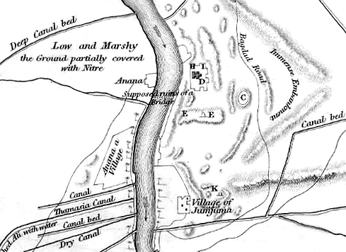
English: Map of the site of Babylon prior to its excavation later in the 19th century. |
| Թուական | (UTC) |
| Աղբիւր |
|
| Հեղինակ |
|
| Սա խմբագրված պատկեր է, որը համեմատ բնօրինակին ենթարկվել է թվային մշակման։ Փոփոխությունները՝ Cropped to show southern area, highlighting the Jumjuma mound: Սկզբնական պատկերը գտնվում է այստեղ՝ Babylon 1829.jpg։ Խմբագրել է ChrisO մասնակիցը։
|
|
This work is in the public domain in its country of origin and other countries and areas where the copyright term is the author's life plus 70 years or fewer.
| |
| This file has been identified as being free of known restrictions under copyright law, including all related and neighboring rights. | |
Original upload log
This image is a derivative work of the following images:
- File:Babylon_1829.jpg licensed with PD-old
- 2010-06-06T22:50:24Z ChrisO 1065x1464 (228517 Bytes) {{Information |Description={{en|1=Map of the site of Babylon prior to its excavation later in the 19th century.}} |Source=Ground Plan of the Remains at & near Babylon |Author=Captain R. Mignan |Date=October 1829 |Permission=
Uploaded with derivativeFX
Նիշքի պատմութիւն
Սեղմել օրուան/ժամին վրայ նիշքի այդ պահուն ունեցած վիճակը տեսնելու համար
| Օր/Ժամ | Մանրապատկեր | Ծաւալ | Գործածող | Մեկնաբանութիւն | |
|---|---|---|---|---|---|
| ընթացիկ | 20:56, 16 Յունիս 2010 | | 489 × 356 (75 ԿԲ) | ChrisO | |
| 23:07, 6 Յունիս 2010 |  | 489 × 356 (88 ԿԲ) | ChrisO | {{Information |Description={{en|1=Map of the site of Babylon prior to its excavation later in the 19th century.}} |Source=*File:Babylon_1829.jpg |Date=2010-06-06 23:07 (UTC) |Author=*File:Babylon_1829.jpg: Captain R. Mignan *derivative work: ~ |
Նիշքի գործածութիւն
Հետեւեալ էջը կը յղուի այս նիշքին՝
Նիշքի համընդհանուր օգտագործում
Հետեւեալ ուիքիները եւս կ'օգտագործեն այս նիշքը՝
- Օգտագործումը ar.wikipedia.org կայքին վրայ
- Օգտագործումը bn.wikipedia.org կայքին վրայ
- Օգտագործումը en.wikipedia.org կայքին վրայ
- Օգտագործումը es.wikipedia.org կայքին վրայ
- Օգտագործումը fa.wikipedia.org կայքին վրայ
- Օգտագործումը fr.wikipedia.org կայքին վրայ
- Օգտագործումը he.wikipedia.org կայքին վրայ
- Օգտագործումը no.wikipedia.org կայքին վրայ
- Օգտագործումը uk.wikipedia.org կայքին վրայ