Պատկեր:Location map of AegeanIslands (Greece).svg

Size of this PNG preview of this SVG file: 693 × 599 կէտիկ. Այլ չափեր: 278 × 240 կէտիկ | 555 × 480 կէտիկ | 888 × 768 կէտիկ | 1184 × 1024 կէտիկ | 2369 × 2048 կէտիկ | 8460 × 7315 կէտիկ.
Սկզբնական նիշք (SVG նիշք, անուանապէս 8460 × 7315 կէտիկ, նիշքի չափը՝ 1,87 ՄԲ)
.svg)
Ամփոփում
| Նկարագրութիւն |
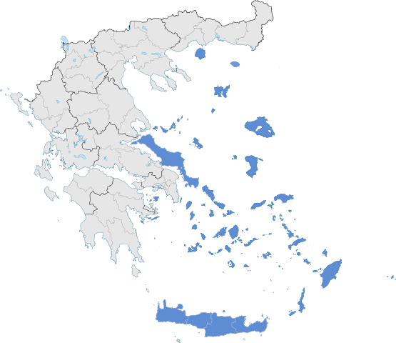
English: The location of Greek Aegean Islands within Greece. |
| Թուական | |
| Աղբիւր | Սեփական աշխատանք |
| Հեղինակ | SilentResident,Philly boy92 |
Արտօնագրում
Ես, սույն աշխատանքի հեղինակային իրավունքների տերը, այսուհետ այն հրատարակում եմ հետևյալ արտոնագրի ներքո։
Այս նիշքը տրամադրելի է Creative Commons Attribution-Share Alike 3.0 Unported արտօնագրի ներքոյ:
- Դուք ազատ էք՝
- կիսել – Աշխատանքը ընդօրինակել, տարածել եւ փոխանցել
- վերափոխել – աշխատանքը յարմարեցնել
- Հետեւեալ պայմաններուն ներքոյ՝
- վերագրում – Աշխատանքը պէտք է վերագրել հեղինակին կամ արտօնատիրոջ պահանջած ձեւով (սակայն ոչ այնպէս մը որ թուայ թէ անոնք կը վաւերացնեն ձեր անոր օգտագործումը)։
- Նոյնապայման տարածում – Եթէ այս աշխատանքը ձեւափոխէք, փոխակերպէք կամ անոր հիման վրայ ստեղծէք ձերը, ապա կրնաք զայն տարածել միայն նոյնպիսի կամ համարժէք արտօնագրով։
Նիշքի պատմութիւն
Սեղմել օրուան/ժամին վրայ նիշքի այդ պահուն ունեցած վիճակը տեսնելու համար
| Օր/Ժամ | Մանրապատկեր | Ծաւալ | Գործածող | Մեկնաբանութիւն | |
|---|---|---|---|---|---|
| ընթացիկ | 06:10, 18 Յուլիս 2021 | | 8460 × 7315 (1,87 ՄԲ) | SilentResident | Correcting Euboea and Crete, which for some strange reason I missed marking them as Aegean Islands even though they are. |
| 03:22, 21 Օգոստոս 2018 |  | 8460 × 7315 (1,83 ՄԲ) | SilentResident | Reverted to version as of 17:09, 17 January 2015 (UTC) The islands are part of geographical Aegean Sea nevertheless. | |
| 11:28, 25 Մարտ 2016 |  | 8460 × 7315 (1,37 ՄԲ) | Nikospag | Thasos and Sporades are not part of Aegean Islands region | |
| 17:09, 17 Յունուար 2015 |  | 8460 × 7315 (1,83 ՄԲ) | SilentResident | {{Information |Description ={{en|1=The location of Greek Aegean Islands within Greece.}} |Source ={{own}} |Author =SilentResident,Philly boy92 |Date =2014-01-17 |Permission... |
Նիշքի գործածութիւն
Հետեւեալ էջը կը յղուի այս նիշքին՝
Նիշքի համընդհանուր օգտագործում
Հետեւեալ ուիքիները եւս կ'օգտագործեն այս նիշքը՝
- Օգտագործումը ar.wikipedia.org կայքին վրայ
- Օգտագործումը el.wikipedia.org կայքին վրայ
- Օգտագործումը en.wikipedia.org կայքին վրայ
- Օգտագործումը eu.wikipedia.org կայքին վրայ
- Օգտագործումը fi.wikipedia.org կայքին վրայ
- Օգտագործումը fr.wikipedia.org կայքին վրայ
- Օգտագործումը ml.wikipedia.org կայքին վրայ
- Օգտագործումը sr.wikipedia.org կայքին վրայ
- Օգտագործումը ta.wikipedia.org կայքին վրայ
- Օգտագործումը th.wikipedia.org կայքին վրայ
- Օգտագործումը www.wikidata.org կայքին վրայ
.svg)