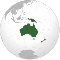
Պատկեր:Oceania (orthographic projection).svg

Size of this PNG preview of this SVG file: 541 × 541 կէտիկ. Այլ չափեր: 240 × 240 կէտիկ | 480 × 480 կէտիկ | 768 × 768 կէտիկ | 1024 × 1024 կէտիկ | 2048 × 2048 կէտիկ.
Սկզբնական նիշք (SVG նիշք, անուանապէս 541 × 541 կէտիկ, նիշքի չափը՝ 63 ԿԲ)
Նիշքի պատմութիւն
Սեղմել օրուան/ժամին վրայ նիշքի այդ պահուն ունեցած վիճակը տեսնելու համար
| Օր/Ժամ | Մանրապատկեր | Ծաւալ | Գործածող | Մեկնաբանութիւն | |
|---|---|---|---|---|---|
| ընթացիկ | 18:54, 6 Փետրուար 2023 |  | 541 × 541 (63 ԿԲ) | Golden Mage | A change to the map of Asia will first face debate from others. Hence, a change to the commonly accepted map of Oceania cannot be made without a wider consensus. |
| 06:33, 6 Փետրուար 2023 |  | 541 × 541 (108 ԿԲ) | Kwamikagami | rv: then perhaps we need to change the Asia map to match. This is as defined in WP. | |
| 18:19, 5 Փետրուար 2023 |  | 541 × 541 (63 ԿԲ) | Golden Mage | Reverted to the map that displays the more accepted definition of Oceania's boundaries. Widely accepted geopolitical definitions take precedence over mere geographical ones. The map of the Wikipedia page for Asia already includes the Maluku Islands. | |
| 05:01, 5 Փետրուար 2023 |  | 541 × 541 (108 ԿԲ) | Treetoes023 | Reverted to version as of 06:27, 24 December 2022 (UTC) | |
| 05:00, 5 Փետրուար 2023 |  | 541 × 541 (63 ԿԲ) | Treetoes023 | Reverted to version as of 13:25, 31 December 2022 (UTC) | |
| 04:55, 5 Փետրուար 2023 |  | 541 × 541 (108 ԿԲ) | Treetoes023 | Reverted to version as of 00:31, 4 December 2022 (UTC) | |
| 13:25, 31 Դեկտեմբեր 2022 |  | 541 × 541 (63 ԿԲ) | Golden Mage | Reverted to the map that displays the more accepted definition of Oceania's boundaries. Widely accepted geopolitical definitions take precedence over mere geographical ones. | |
| 06:27, 24 Դեկտեմբեր 2022 |  | 541 × 541 (108 ԿԲ) | Kwamikagami | Reverted to version as of 00:31, 4 December 2022 (UTC) definition per WP-en | |
| 06:13, 22 Դեկտեմբեր 2022 |  | 541 × 541 (63 ԿԲ) | Golden Mage | Reverted to the map that displays the more accepted definition of Oceania's boundaries. | |
| 00:31, 4 Դեկտեմբեր 2022 |  | 541 × 541 (108 ԿԲ) | Kwamikagami | the Weber line divides Oceanic from Asian Wallacea |
Նիշքի գործածութիւն
Հետեւեալ էջը կը յղուի այս նիշքին՝
Նիշքի համընդհանուր օգտագործում
Հետեւեալ ուիքիները եւս կ'օգտագործեն այս նիշքը՝
- Օգտագործումը ab.wikipedia.org կայքին վրայ
- Օգտագործումը ady.wikipedia.org կայքին վրայ
- Օգտագործումը af.wikipedia.org կայքին վրայ
- Afrika
- Asië
- Europa
- Kiribati
- Noord-Amerika
- Suid-Amerika
- Vanuatu
- Guam
- Nieu-Seeland
- Sjabloon:Kontinente
- Australië
- Nauru
- Wellington, Nieu-Seeland
- Hoofstad
- Lys van hoofstede
- Sjabloon:Lande van Oseanië
- Honolulu
- Antarktika
- Gondwana
- Eurasië
- Laurasië
- Kategorie:Lande in Oseanië
- Lys van lande
- Fidji
- Canberra
- Hawaii
- Lys van nasionale leuses
- Clipperton
- Oseanië
- Norfolkeiland
- Amerikas
- Tonga
- Tuvalu
- Sjabloon:Hoofstede in Oseanië
- Palau
- Australië (kontinent)
- Afrika-Eurasië
- Samoa
- Marshalleilande
- Salomonseilande
- Papoea-Nieu-Guinee
- Gefedereerde State van Mikronesië
- Nukuʻalofa
- Port Moresby
- Apia
- Funafuti
- Honiara
- Majuro
Տեսնել այս նիշքի աւելի համընդհանուր օգտագործումը:
